Posted on

1/25/2012 — State of the Union address = WHAT THE FRACK?!

watch my video assessment here:


———————————————–

Also you can watch the State of the Union address here:


(at about 29 minutes President Obama speaks about “fracking”).

————————————————–

Screenshot of the Presidents proposed NEW FRACKING/DRILLING plan !

Title of this post says it.. W.T.F.  … what the frack ?!

Look at the diagram to the right of President Obama…

This is the NEW PROPOSED map of “fracking” and “drilling” sites …

Wait a second…

Step back from this above map for a second.. look at it in a ‘broader’ sense —– where have we seen this shape before?!

Oh yes… now I can place it… it took me a second…

————————

Yes, thats right.. if you compare the two maps.. the NEW PROPOSED drilling/frac well sites…. alongside the diagram of the actual NORTH AMERICAN CRATON….. they are planning on drilling / injecting / fracking the entire edge of the north american plate [commonly called “Laurentia”].

===========================

Now look at the past 2 weeks of earthquakes in north america — 1/12/2012 through 1/25/2012 .

See a familiar pattern? Just connect the dots — the earthquakes across the United states are falling along the edge of the north american craton.

These earthquakes of course have multiple causes.. some are at dormant volcanoes with deep shafts into the earths crusts.. however SEVERAL of the earthquakes shown on this screenshot above (in NM, CO, TX, OK, AR, TN, VA, OH, and NY) … all were at fracking/drilling sites !

This says to me, that ANYWHERE that a deep shaft has been dug into the earth, or at dormant volcanoes which have open tubes into the earths crust ….. we can expect to see an uptick in earthquake activity due to the global unrest.

Just like the punctured edges on a perforated piece of paper make it easier to tear the paper apart…. these man made Fracking/Drilling punctures in the earth crust are making it easier for the Pacific plate to “move” the North American Craton.

One more time.. lets compare all three diagrams—earthquakes for the past 2 weeks (Left), drilling / fracking sites (middle), Geologists diagram of Craton (right):

here are my past posts on the subject:

http://sincedutch.wordpress.com/?s=frack

past videos on frac well injection drilling:

http://www.youtube.com/results?search_query=frack+dutchsinse&oq=frack+dutchsinse&aq=f&aqi=&aql=&gs_sm=e&gs_upl=3180742l3183317l0l3183517l16l15l0l8l0l0l196l1115l1.6l7l0

Posted on

1/24/2012 — MSM headline — Tokyo HIGH (large) QUAKE probability = 70-98% chance

watch the video report here:

——————————————————


Full story here:

http://www.cnn.com/2012/01/24/world/asia/tokyo-quake-forecast/index.html?hpt=hp_t3

Tokyo sees high quake probability, scientists warn

By Elizabeth Yuan, CNN
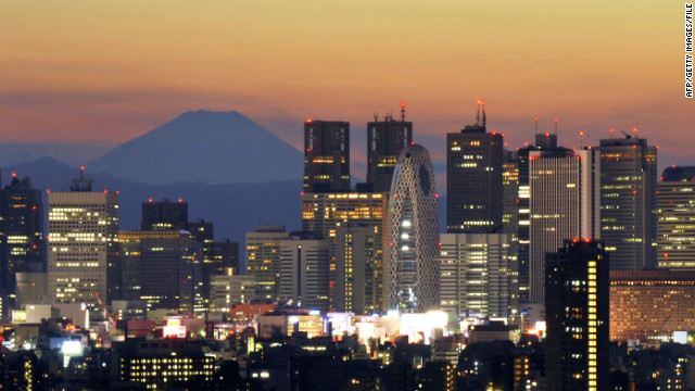
Japan's highest mountain, Mount Fuji, rises behind Tokyo's skyscraper skyline, as the sun sets in this photo last year.
“Japan’s highest mountain, Mount Fuji, rises behind Tokyo’s skyscraper skyline, as the sun sets in this photo last year.
STORY HIGHLIGHTS
  • Forty-two million people live in Tokyo metropolitan area
  • University researchers cited findings on increase in small tremors
  • Government put 70% probability of magnitude-7 quake in region within 30 years
  • March 11 quake and tsunami left more than 15,700 dead, government says

(CNN) — Tokyo faces the possibility of being hit by a massive earthquake within the next four years, according to Japanese researchers.

The University of Tokyo’s Earthquake Research Institute predicts there is a 70% probability that the capital’s metropolitan area will experience a magnitude-7 quake within four years and a 98% probability within the next 30 years.

Nearly one year ago, a magnitude 9.0 quake struck off Japan’s central Pacific coast, triggering a devastating tsunami and aftershocks that left more than 15,700 dead, according to a government report in December on Japan’s recovery from the catastrophe. About 4,500 were listed as missing.

Nearly 700 aftershocks registering magnitude 5 or greater followed last year’s quake, the government report said.

The March 11 earthquake — dubbed “Tohoku” after the region in which it occurred — also damaged the Fukushima Dai-ichi nuclear power station, where three reactors experienced full meltdowns, creating a nuclear crisis for a country already grappling with disaster.

Quake, tsunami debris threaten coastlines

The research institute cited for its findings the Gutenberg Richter Law, which states that an increase in small tremors will likely increase the number of larger earthquakes. According to another paper published in September, the institute concluded that the quake ruptured a fault area nearly 500 kilometers in length and 200 kilometers wide offshore.

The fourth strongest quake recorded in history, Tohoku caused abrupt stress changes in the upper plate and triggered widespread seismic activity throughout the Japanese island. The northern part of Ibaraki Prefecture, in particular, saw a significant increase of shallow seismicity after the quake compared with the extremely low rate eight years prior, the researchers said.

Should Tokyo’s inhabitants be worried?

The research institute’s findings carry great consequences for the 42 million people who live in the Tokyo metropolitan area. The Central Disaster Management Council has estimated that a large-scale earthquake in the next few decades could result in 11,000 deaths and an economic loss of 112 trillion yen (US$1 trillion). Its goal is to halve the estimated death toll and reduce the estimated economic loss.

How precise are seismic forecasts?

Gary Gibson, a seismologist at Australia’s Seismology Research Centre Seismology Research Centre, called the Earthquake Research Institute’s findings “not at all unexpected,” given the level of seismic activity and their model.

“Seismologists cannot predict with certainty when, where and how large the next big earthquake will be,” he wrote in an e-mail to CNN. “However, it is possible to forecast the probability of an earthquake in a particular time range (e.g. the next four years), location area (e.g. the Tokyo region), and magnitude range (e.g. greater than magnitude 7.0).

“Long-term forecasts use average activity levels from past earthquakes, geological data from fault displacements, and data about plate movement and deformation from very precise GPS measurements and other methods to determine these probabilities.”

What is the government saying?

The government’s Headquarters for Earthquake Research Promotion had put a 70% probability of a magnitude-7 quake in Kanto region, which encompasses Tokyo and Yokohama, within 30 years, based on long-term seismicity and hazard studies.

Scientists have already dubbed as “Tokai” an expected 8.0 quake near Suruga Bay, where large quakes have historically struck every 100-150 years, according to the Japan Meteorological Agency. The last one, a magnitude-8.4 quake, occurred in 1854 — nearly 160 years ago.

According to Gibson, the seismologist, the enhanced seismicity in the area affected by the Tohoku quake may fall towards normal levels and could affect the research institute’s findings. Results for the six-month period after the quake would become available after this coming March 11…. (read whole article at link above)